Geographical definition of the area
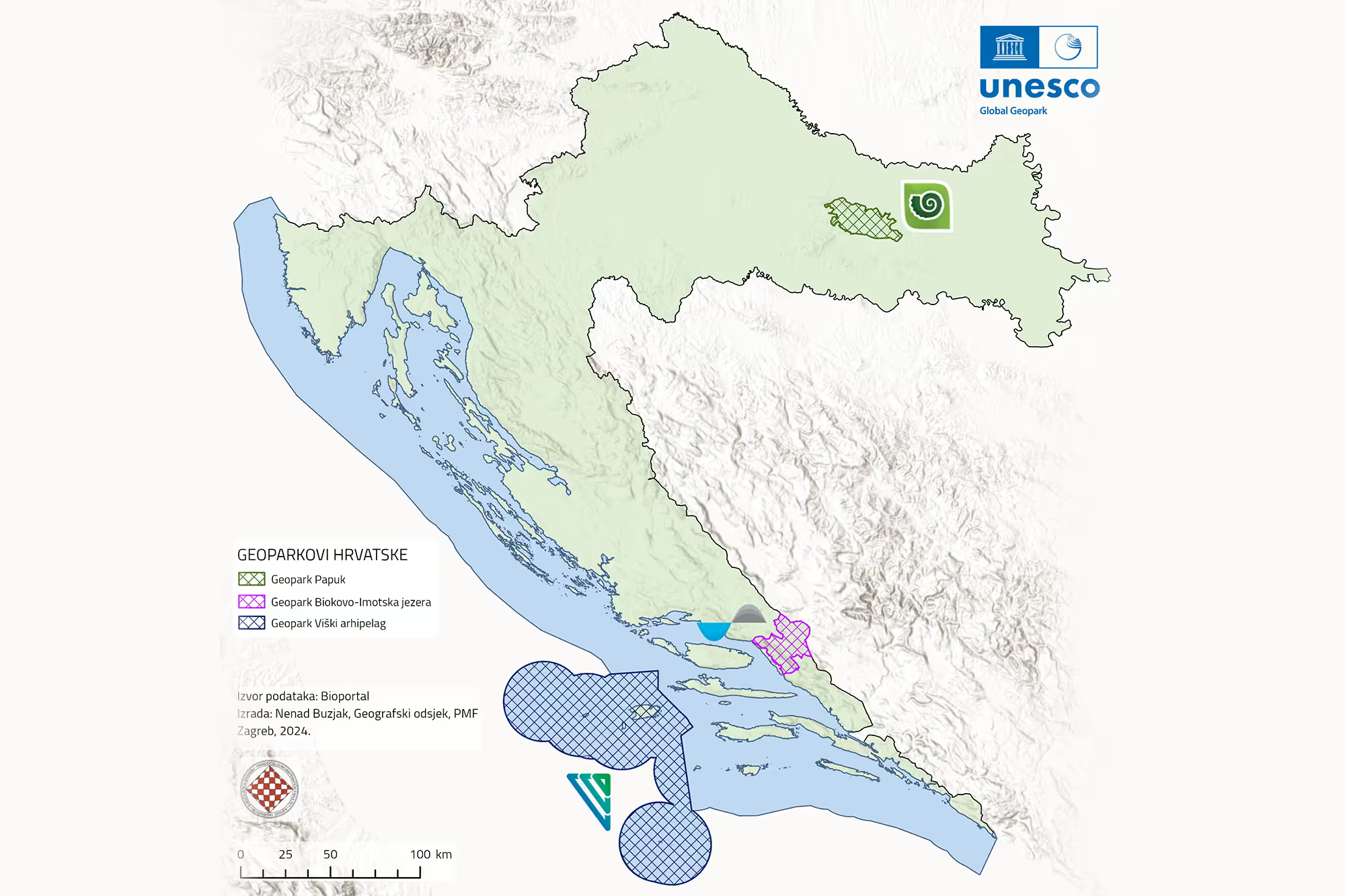
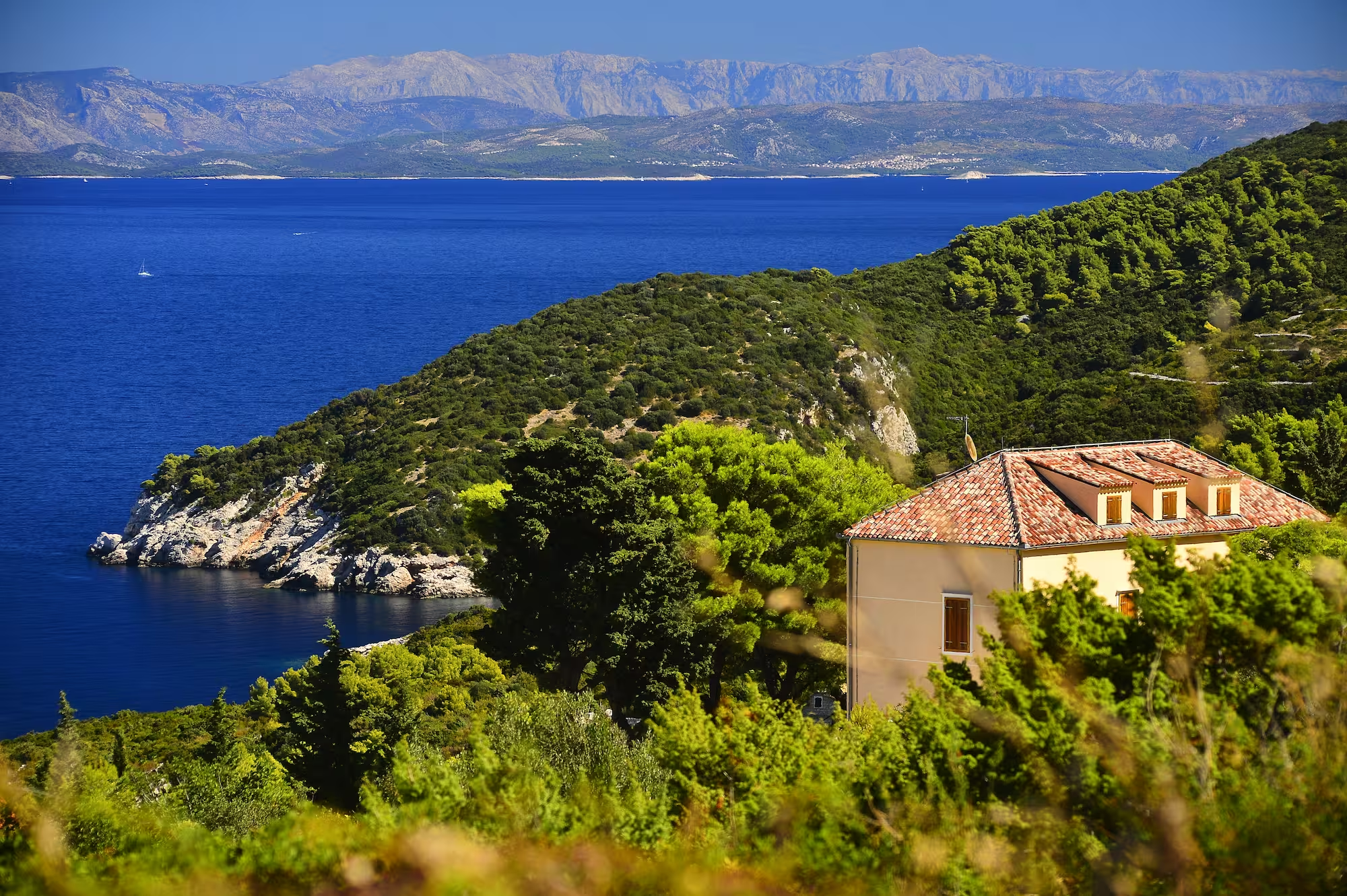
The Vis Archipelago UNESCO Global Geopark encompasses an integrated island–marine area located in the central part of the Adriatic Sea, within the eastern Adriatic region of the Republic of Croatia. It represents a distinctive spatial unit formed by a group of interconnected islands, islets, and marine areas shaped by long-term geological and geomorphological processes.
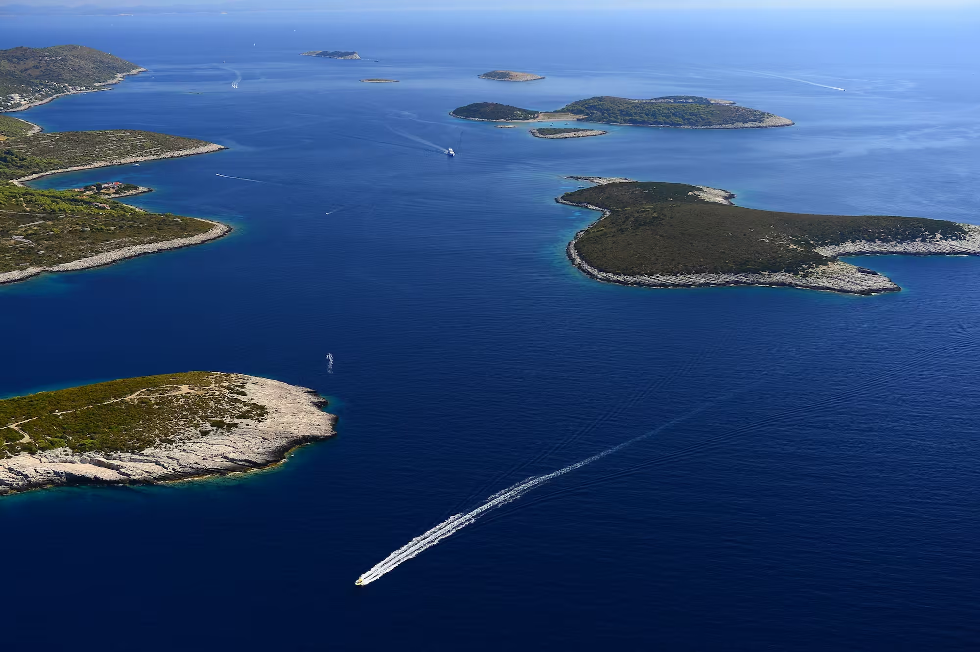
The central landmass of the geopark is the island of Vis, around which several larger offshore islands are distributed, including Biševo, Sveti Andrija (Svetac), Jabuka, Brusnik, and Palagruža, as well as numerous smaller islets, rocks, and reefs such as Ravnik, Budihovac, Veli and Mali Paržanj, Greben, Host, and Veli and Mali Barjak. Together, these islands form a characteristic island chain extending towards the open sea and creating a recognisable geographical structure within the central Adriatic.
The total area of the geopark covers 6,661 km², of which approximately 101 km² is land, while the remaining part consists of the surrounding marine area with associated underwater elevations, ridges, and open sea. This structure creates a highly indented and dynamic landscape in which landforms, steep coastal cliffs, sheltered bays, underwater thresholds, and open marine spaces alternate.
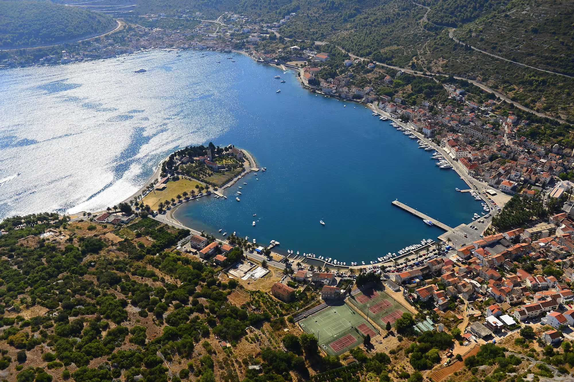
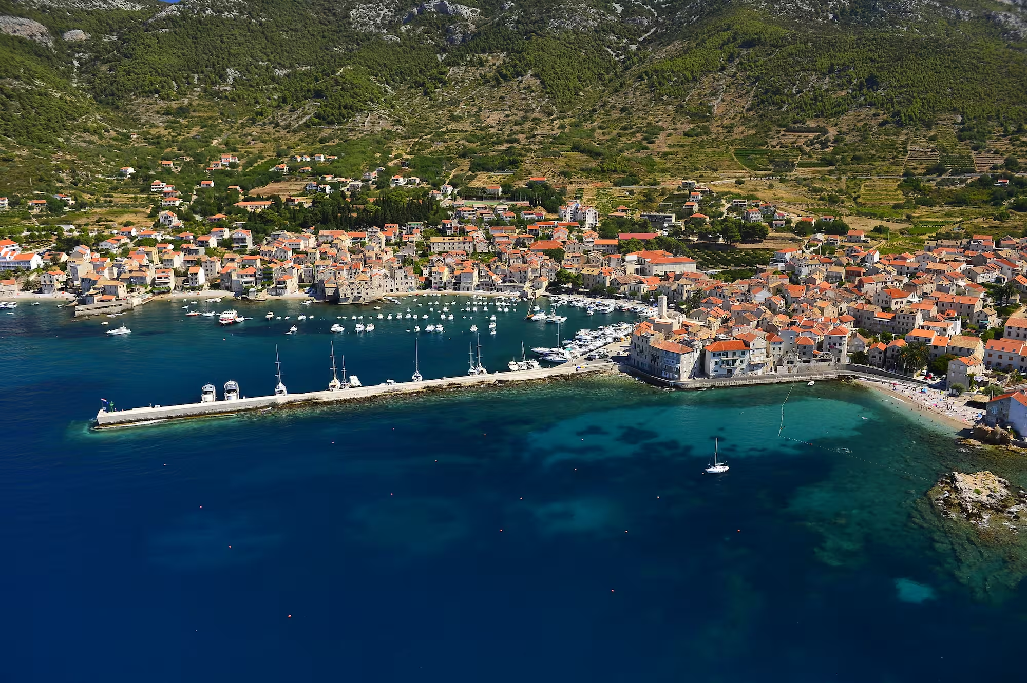
The archipelago comprises a total of 51 landforms (islands, islets, or rocks). Among them, three islands are permanently inhabited: Vis, Biševo, and Sveti Andrija (Svetac). The permanent population is almost entirely concentrated on the island of Vis, in the towns of Vis and Komiža, while the other islands are largely uninhabited or used only seasonally. According to the 2021 population census, the archipelago has 3,322 inhabitants, making it one of the sparsely populated island regions of the central Adriatic.
The geographical boundaries of the geopark are further defined by several notable extreme points. The northernmost and westernmost point is the island of Jabuka, while the southernmost point is the reef Galijula, which also represents the southernmost point of the Republic of Croatia. The easternmost point is the island of Greben, and the highest point is Hum on the island of Vis, rising to 587 metres above sea level.
The area of the Vis Archipelago is characterised by a Mediterranean climate, with warm, dry summers and mild, wetter winters. The surrounding marine environment reflects typical Adriatic oceanographic conditions, including seasonal variations in sea temperature, salinity, and marine currents, all of which influence coastal morphology, underwater relief, and marine habitats.
Located far from the mainland, the Vis Archipelago represents the most remote permanently inhabited island group from the Croatian mainland. Its position in the open sea highlights its connection with historic maritime routes that for centuries linked central Dalmatia with the southern and central parts of the Adriatic Sea.
The geopark area is marked by a remarkable diversity of landscapes, ranging from karst landforms on the island of Vis, to steep coastal cliffs on Biševo and Svetac, isolated volcanic islands such as Jabuka and Brusnik, and offshore reefs and submarine elevations in the Palagruža area. This combination of terrestrial and submarine features gives the Vis Archipelago a distinctive geomorphological identity.
The entire land area of the geopark and a significant part of its marine area are included in the European ecological network Natura 2000, further emphasising its outstanding natural value and the need for its long-term conservation.

Hrvatskih mučenika 17
21485 Komiža, Croatia
+385 91 271 30 23
geopark@geopark-vis.com
Fotografije: Ivo Pervan, Matko Petrić, Stjepan Mekinić
Design & development: P3R0