Water on the Island of Vis – an Invaluable Island Resource and a Natural Laboratory for Science
Water on the Island of Vis is an invaluable resource for both the island’s residents and its visitors. The occurrence of significant groundwater reserves on a karst island, sufficient to ensure self-sufficiency in water supply, is an exceptional natural phenomenon. For this reason, numerous research projects aim to better understand this system: to identify patterns, connect hydrogeological and geological processes, and predict the future state of the island’s most important resource.
One such scientific project is “From Sea to Summit: Sustainable Management of Sensitive Karst Aquifers under Climate Change and Anthropogenic Stress.” The project is funded by the Croatian Science Foundation and the Swiss National Science Foundation, and is carried out by the Faculty of Civil Engineering, Architecture and Geodesy, University of Split, and the Centre for Hydrogeology and Geothermics, University of Neuchâtel, Switzerland.
In the Swiss part of the project, the research area is the Glarey karst spring, which supplies drinking water to the municipality of Conthey in the Canton of Valais and the surrounding area. The spring is recharged through a complex system of karst aquifers and a surface glacier, and climate change is expected to have a significant impact on its future discharge. Similar challenges are expected on the Island of Vis, where climate change will affect the recharge of the freshwater lens, while increased water consumption during the tourist season represents an additional pressure.
Although the Swiss and Croatian study sites are hydrogeologically different, they are connected by the sensitivity of karst aquifers to climatic and anthropogenic changes. Due to its specific geological features, the Island of Vis represents a unique natural laboratory for studying the dynamics of surface water and groundwater within a relatively small area of approximately 90 km².
The From Sea to Summit project has provided the scientific community with real-time insight into the current state of groundwater on the Island of Vis. This has been achieved by equipping an existing research borehole with scientific monitoring and telemetry equipment, and by establishing monitoring of key parameters that define the dynamics of groundwater and surface water. These include groundwater level, temperature and electrical conductivity, discharge at the Pizdica spring, and climatic and meteorological parameters in the Korita wellfield area.
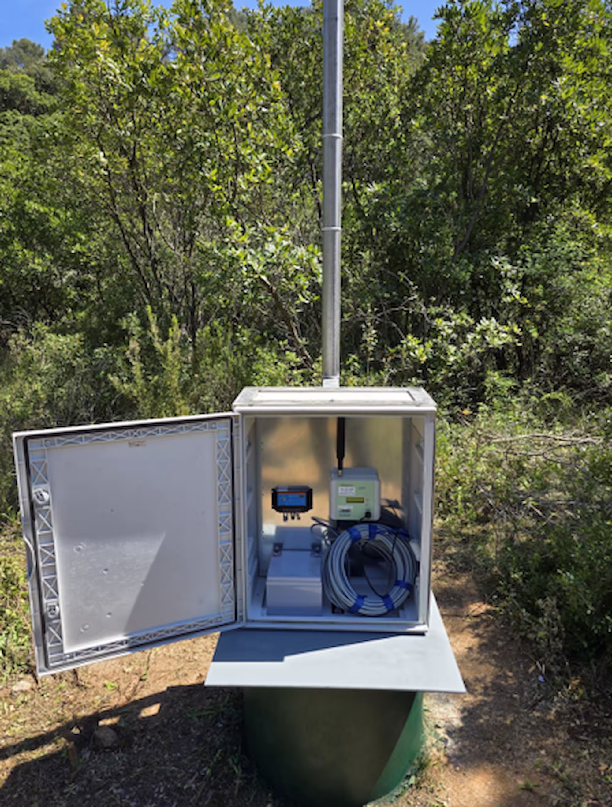
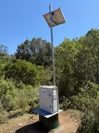
The research borehole at the Korita wellfield has been equipped with a sensor for measuring groundwater level, temperature and electrical conductivity (Figure 1 and 2). The measured data are recorded and transmitted in real time to a server, from which they can be viewed, downloaded and analysed. The data are available here.
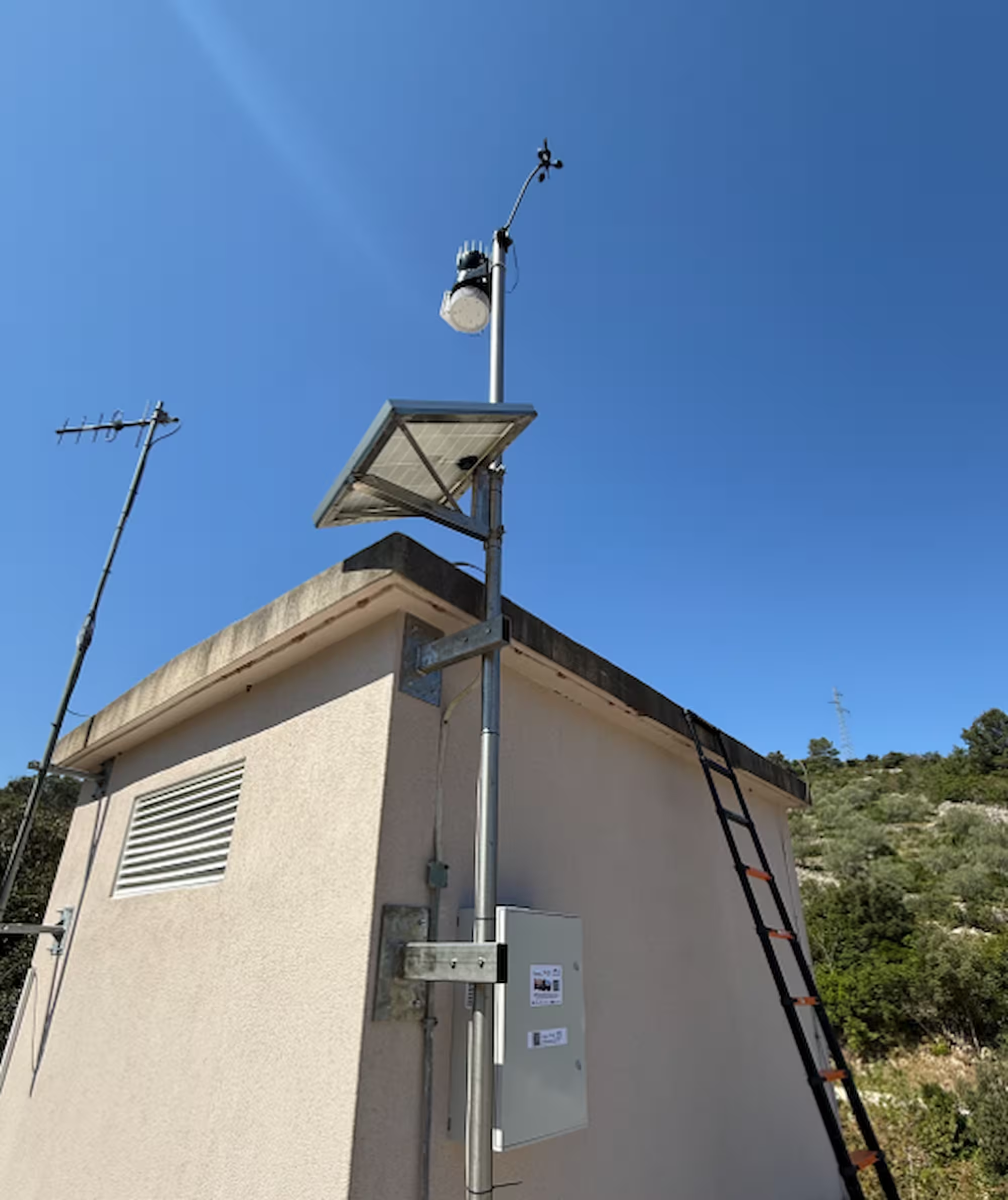
In addition, an automatic meteorological station has been installed at the Korita site (Figure 3). This location is highly important for analysing the dynamics of aquifer recharge, as it enables simultaneous monitoring of meteorological conditions and groundwater response. As with the groundwater monitoring sensors, meteorological data are available in real time at the following link.
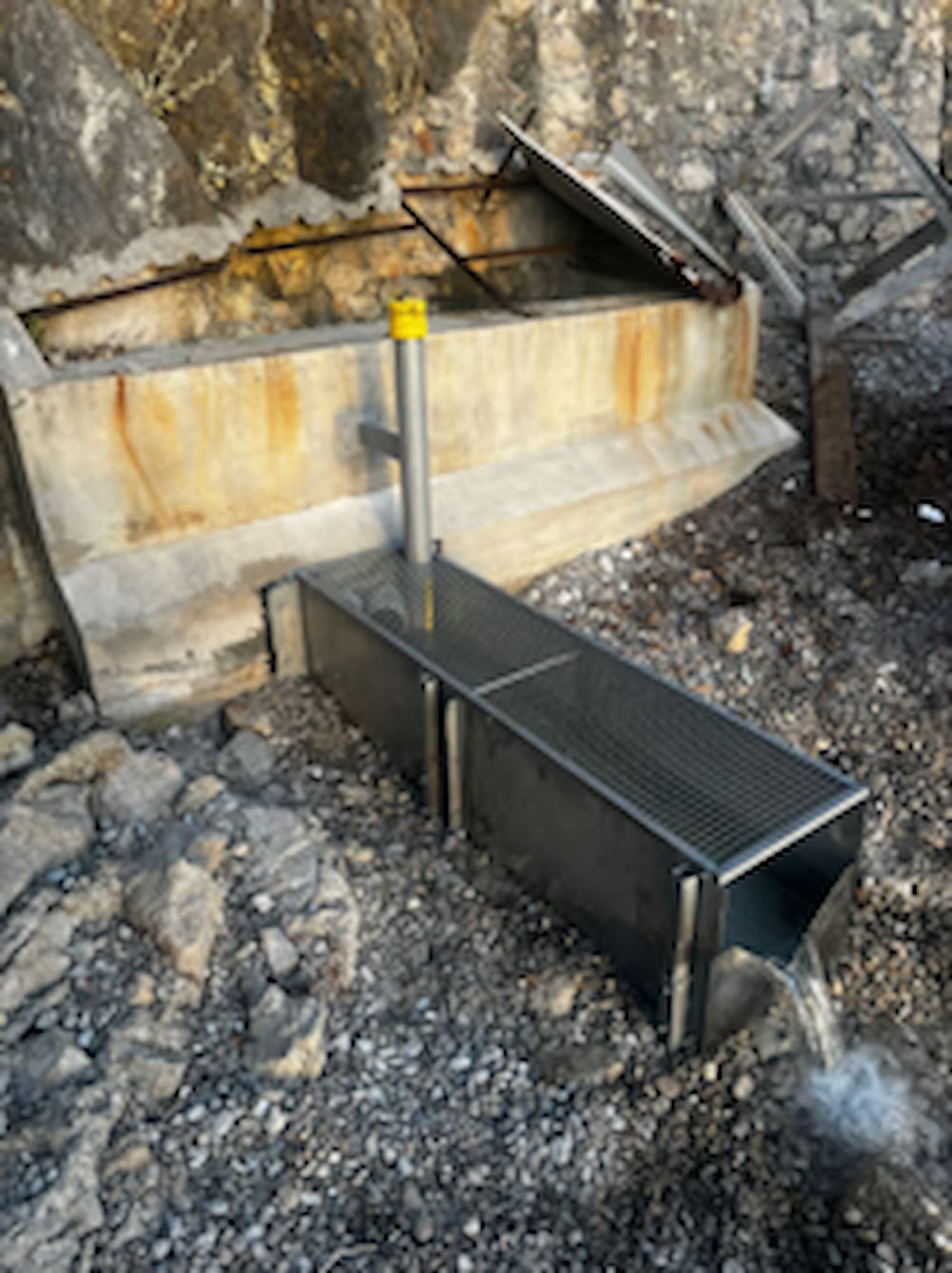
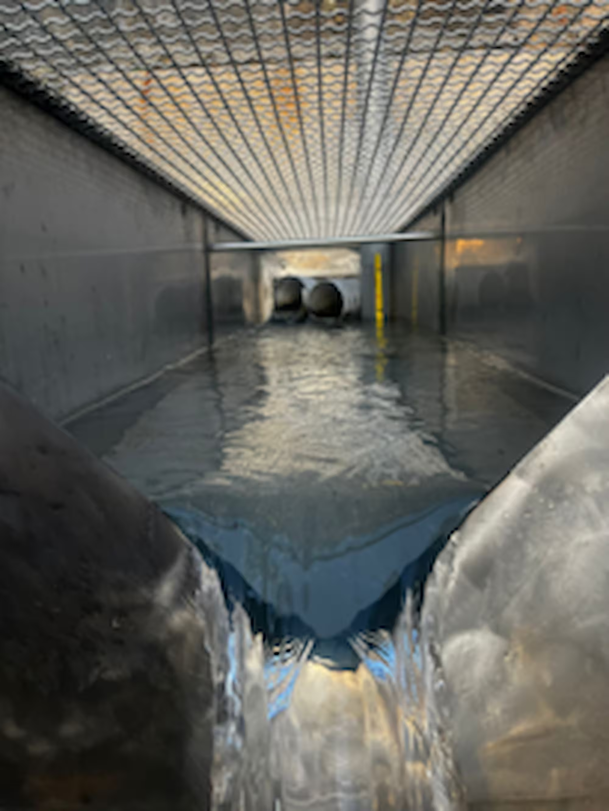
The Pizdica spring represents a particular organisational and technical challenge for scientific fieldwork and research activities. Establishing a hydrological station at such a location requires an additional level of field preparation, expertise and coordination (Figure 4 and 5). Nevertheless, the project has enabled the establishment of the Pizdica hydrological station, which will measure not only spring discharge but also basic physico-chemical water parameters. By the end of the year, this station is planned to be integrated into the project’s unified database and direct telemetry system.
In this way, the From Sea to Summit project contributes to a better understanding of the island’s water system and to the long-term protection of the most important natural resource of the Island of Vis. Systematic monitoring of groundwater and surface water will enable more precise assessments of the impacts of climate change, drought periods and increased seasonal water demand. This provides a foundation for the sustainable management of the island’s water resources, in line with the values and objectives of the UNESCO Global Geopark Vis Archipelago.
More information about the From Sea to Summit project is available on the website of the Faculty of Civil Engineering, Architecture and Geodesy, University of Split:
https://gradst.unist.hr/eng/research/projects/hrzz-ip-and-uip/from-sea-to-summit
and on the official project website:
https://from-sea-to-summit.github.io


Posljednje novosti

Hrvatskih mučenika 17
21485 Komiža, Croatia
+385 91 271 30 23
geopark@geopark-vis.com
Fotografije: Ivo Pervan, Matko Petrić, Stjepan Mekinić
Design & development: P3R0